When Reality Capture Meets 4D Planning
In a recent joint webinar, cmBuilder.io and DroneDeploy welcomed construction leaders from PCL Construction, KAST Construction, and Juneau Construction to explore how reality capture and 4D simulations are reshaping the pre-construction phase. Each speaker pulled back the curtain on how pairing DroneDeploy’s aerial + 360° capture with cmBuilder’s web-based site-logistics and 4D simulation is reshaping the earliest—and riskiest—stage of every project. The common thread? Better context, faster decisions, and fewer surprises when the shovels finally hit the dirt.
PCL Construction: Visualizing Constraints Before They Become Problems
Amir Jalali, Integrated Construction Technology Manager at PCL, shared their approach to tackling the $1.7B redevelopment of Burnaby Hospital in British Columbia. The project involves demolishing a central T-shaped building while keeping the rest of the hospital operational—a task full of logistical and safety risks.
To capture the interior conditions, PCL turned to DroneDeploy Ground, documenting hallways and restricted zones with 360-degree imagery. Given the hospital’s active status and strict infection control measures, access was limited. By capturing high-resolution virtual walkthroughs, PCL was able to share this critical context with a broader internal team and trade partners—without repeated site visits.
On the exterior, DroneDeploy’s aerial capture enabled panoramic views of the surrounding area, including nearby power lines and tight access points. They combined these visuals with GPR scans of underground services and overlaid PDF schematics to create a layered understanding of the site’s constraints.
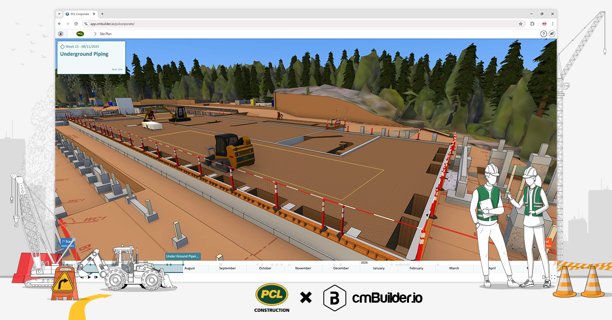
From there, PCL brought all this data into cmBuilder, where they simulated the demolition, rerouting of utilities, and site logistics in 4D. They created an easily shareable logistics animation that helped everyone—from engineers to hospital officials to nearby residents—understand the sequence and safety measures.
Key takeaways:
· Interior 360 imagery reduced site access challenges.
· Stacked drone and scan data eliminated surprises in excavation planning.
· cmBuilder animations created a common language for technical and non-technical stakeholders alike.
KAST Construction: Using 4D to Win the Work—And Build Smarter
Jodi Hanchey, Senior VDC Manager at KAST Construction, provided a behind-the-scenes look at how their Florida-based team uses DroneDeploy and cmBuilder across both pursuit and pre-construction phases.
In a competitive RFP for a beachfront hotel, KAST used DroneDeploy to fly the site and surrounding areas. While most bidders used outdated satellite imagery, KAST identified a new public park under development next to the site—something others missed. Including that context in their submission impressed the owner and played a key role in KAST being selected.
Once awarded, their planning accelerated. Jodi described how her team receives incoming logistics requests and quickly turns them around with DroneDeploy maps and cmBuilder 3D logistics plans. These visuals were especially useful for submissions to municipalities. In one project, they used cmBuilder to create a logistics simulation that convinced the City of Sarasota to approve complex tower crane air rights—while also showing adjacent property owners how crane swings would be managed to avoid encroachments.
KAST also leveraged these visuals to bring their trade partners into pre-con planning early. With mock-ups available through 360 photos, subcontractors could virtually walk the spaces and flag constructability or access concerns before mobilizing.
Key takeaways:
· Real-time drone imagery set KAST apart in RFPs.
· cmBuilder plans improved permitting success and neighbor relations.
· Sharing visuals early helped reduce scope gaps and fostered trade alignment.
Juneau Construction: Driving Pre-con Decisions with Field-Ready Models
Wilson Haworth, Director of Virtual Design at Juneau, highlighted their work on One Park Sarasota, a 19-story ultra-luxury condo project. With a fast-moving schedule and limited site data, the Juneau team needed to make informed decisions quickly.
From day one, Juneau captured 360 panoramas and high-resolution maps using DroneDeploy. That upfront data became the foundation for identifying site risks, such as a neighboring high-rise that could interfere with tower crane swing. Using drone-based height measurements and cmBuilder’s resources, they optimized crane location and site logistics in the early design stage—avoiding future budget surprises.
What stood out was how much of the cmBuilder modeling was done by Juneau’s superintendents themselves. The tool’s ease of use empowered site leads to build, iterate, and even animate site logistics plans that directly informed scheduling, site access, and safety planning.
In another case, Juneau discovered through cmBuilder that their building footprint extended dangerously close to a creek. They returned with RTK drone flights and control points to validate erosion near the foundation—allowing the team to proactively engage civil engineers and address the issue before breaking ground.
Key takeaways:
· Field teams used cmBuilder directly, accelerating decision-making.
· DroneDeploy enabled quick detection of potential site hazards.
· Early logistics modeling influenced both budget and design coordination.
Final Thoughts
From active hospitals to congested city lots to undeveloped coastal sites, the challenges in pre-construction are varied—but the goals are the same: capture reality early, simulate often, share widely
DroneDeploy provides the millimeter-accurate snapshot; cmBuilder turns that snapshot into an interactive construction playbook. Whether you’re protecting patients in Vancouver, navigating Florida’s FAA corridors, or chasing shifting creek banks in South Carolina, the duo gives pre-con teams the context they need to plan with confidence—and to communicate it to stakeholders.


